Uncovering Hidden Hazards: Leveraging Earth Observation to Protect Marine Ecosystems
Viridien Stories | Feb 7, 2025

Leakage from shipwrecks poses a material risk to sensitive marine environments. The data from Earth Observation satellites offers a unique opportunity for the location of newly identified wrecks, and long-term monitoring of these risks. Here, we demonstrate examples from a potential shipwreck off the Scottish East coast, deploying Viridien’s thirty years of experience as a leading provider of oil spill monitoring solutions in the maritime environment, to address this risk.
The world’s oceans are home to an estimated 3 million sunken or abandoned vessels, with over 8,500 of them classified as 'potentially polluting wrecks’ (IUCN, 2023). As the frequency of severe weather events rises with climate change, there is an increasing risk of disruption and damage to shipwrecks and therefore subsequent oil releases (Sturt, 2024). Leaking oil from these wrecks can devastate marine ecosystems, harming wildlife and disrupting vital habitats.
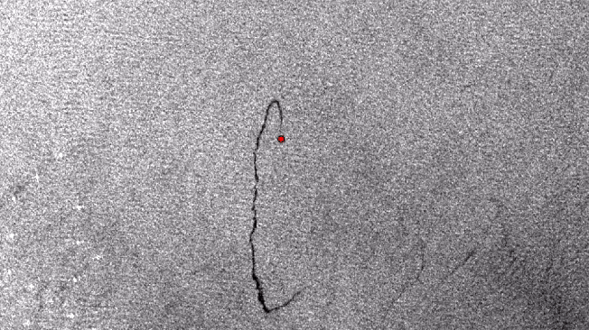
Whilst many wrecks are those that date back to World War I and II, more recent vessels are also contributing to the ongoing issues of marine pollution. One example is a vessel located in the Firth of Forth Montrose Bank Marine Protected Area (WDPA), located approximately 65km east of Montrose, Angus in Scotland (Figure 1). Details on the identity of the leaking wreck remains largely obscure ( However, should you have any relevant information, we would welcome the opportunity to discuss it further with you), with little publicly available data, highlighting the challenges of addressing such incidents. However, observations of oil slicks by the automated SeaScope system suggest that this wreck is actively leaking oil, as indicated by recurring detections in the area (Figure 2).
Figure 1 – Estimated location of wreck within the Firth of Forth Banks Marine Protected Area. Wreck location from UK Hydrographic Office (2024) coincides with slicks observed (Basemap © ESRI, EMODnet World Database on Protected Areas).

The slicks originating from this wreck between 2022-2024, vary in size, ranging from less than 1km to approximately 8km in length. The slicks seen in Figure 2 represent a subset of the most prominent examples originating from the wreck seen on Sentinel-1 imagery; however, slicks are observed throughout the year, indicating ongoing activity and can be seen as far back as 2014 on Sentinel-1 (SeaScope’s ML algorithms utilising HPC identify 78 detections across 2245 scenes). This variability highlights the need for monitoring and analysis to understand the scale and impact of the pollution. The information generated by Viridien's subject matter experts is integrated into the SeaScope system, a cutting-edge platform designed to analyze and interpret complex geospatial data. Once the expert-generated information is uploaded, the SeaScope system uses its advanced algorithms and capabilities to interrogate a wide range of global datasets, including vessel locations, marine infrastructure and known wreck locations.
Through this analysis, the SeaScope system identifies patterns and anomalies that may indicate the presence of consistent oil leakage. By cross-referencing the expert-generated geo-information with the available global data, the system can flag potential sites of oil leakage with a high degree of accuracy.
Whilst data is not widely available on this specific wreck, shipwrecks around the UK are well-documented as functioning as artificial reefs, providing habitats that support and enhance marine biodiversity (Hickman et al., 2023). Shipwrecks provide hard substrate in otherwise soft sediment habitats, creating unique environments where marine organisms can colonize and thrive. However, loss of hydrocarbons into the local environment can threaten the success of these reefs across the longer term. In this case, the location of the wreck, within the Montrose Bank Marine Protected Area is of particular concern. This MPA, designated in 2014, is part of the larger Firth of Forth Banks MPA complex which is approximately 2,130 km² in size with depths ranging from 30-110m (JNCC, 2024). Ocean quahog populations (Arctica islandica), a marine bivalve of conservation importance, are found here alongside scientifically significant moraines. These moraines provide a structurally diverse seabed habitat, supporting a variety of marine life, and offer valuable insights into Scotland’s glacial history (JNCC, 2024).
Whilst low-level and localized leakage may not cause catastrophic effects – with certain species able to adapt or colonize unaffected parts of the wreck - monitoring leakage is crucial to identify changes over time and prevent long-term environmental degradation. Persistent leaks can gradually harm sensitive species, disrupt ecological balance, and spread pollutants to other surrounding habitats. Proactive monitoring allows for timely interventions, supporting biodiversity conservation and providing critical data for managing the risks associated with wrecks.
Despite this location being well-mapped, studied, and designated as a Marine Protected Area, hydrocarbon losses continue to be detected here. Advancing technologies and collaborative initiatives are needed to address these ongoing challenges in the marine environment.
References:
- Hickman, J., Richards, J., Rees, A., Sheehan, E, V. (2024) Shipwrecks act as de facto Marine Protected Areas in areas of heavy fishing pressure. Marine Ecology, 45(1)-(Accessed: 7 January 2025)
- IUCN (2023) Marine pollution from sunken vessels. IUCN - (Accessed: 7 January 2025)
- JNCC (2024) Firth of Forth Banks Complex MPA. JNCC - (Accessed: 7 January 2025)
- Sturt, F. (2024) Polluting shipwrecks are the ticking time-bomb at the bottom of our oceans. The Conversation - (Accessed: 7 January 2025)
- UK Hydrographic Office (2024) Wrecks and Obstructions Shapefiles. Admirality - (Accessed: 16 January 2025)