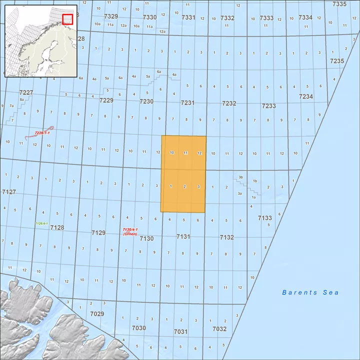
Finnmark Platform
Explore this prospective area of the Barents Sea with 3D broadband seismic
Viridien’s FIN13 BroadSeis™ 3D broadband dataset, located on the northern part of the Finnmark Platform, provides clear images for exploration for a range of play types with a comprehensive PSTM processing sequence that removes noise and multiples. Data from nearby wells prove this area to be multi-source; it is also considered to be a combined oil and gas province. Both the Nordkapp Basin and the Tiddlybank Basin are expected to be possible source rock areas for this area, in addition to local migration.
Highlights
- 2,301 square kilometers of 3D long-offset broadband data imaging play models at several stratigraphic levels in this prospective area
- Reservoir charge from both local and long-distance migration from source rocks possible

Related Technology & Surveys

Greater Castberg
Get superior imaging with our state-of-the-art TopSeis™ data for shallow-to-intermediate-depth targets in the Barents Sea.
Cornerstone Surveys
Get comprehensive seismic data coverage for the Central North Sea, including 50,000 km2 of PSDM data.
Explore available multi-client data using our interactive map.
Explore the GeoStore