Santos and Campos Basins
Unlock New Exploration Opportunities in Offshore Brazil
Maximize your chances of success in pre-salt exploration with Viridien’s premium seismic data, covering more than 100,000 km2 of contiguous, high-quality broadband pre-stack depth migrated (PSDM) seismic data in the highly prospective Santos and Campos Basins in Brazil. Our deliverables include TTI RTM PSDM and TTI Kirchhoff PSDM, utilizing advanced technologies like 3D deghosting, internal multiple attenuation (IMA), and full-waveform inversion (FWI), including time-lag FWI.
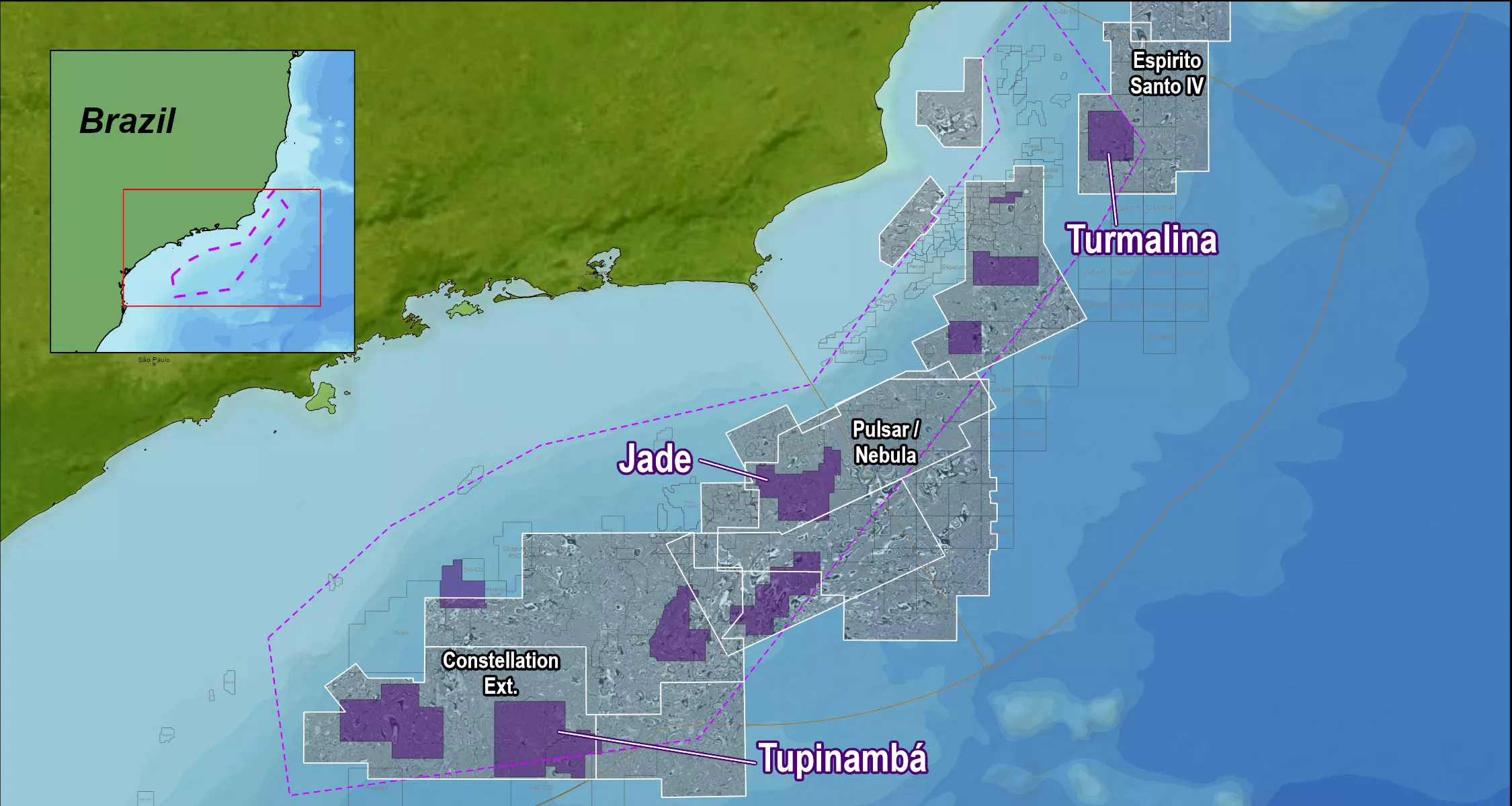
Comprehensive Survey Portfolio


Nebula A 3D Survey: Precision Focus
Dual-azimuth acquisition with cutting-edge processing resolves intricate structural complexities. Repeated tomography and TL-FWI iterations deliver exceptional salt scenario definition, addressing Brazil’s unique geological challenges.
Why Choose Viridien?
Partner with Viridien for industry-leading seismic data solutions designed to meet the demanding exploration needs of offshore Brazil. Our advanced imaging technology, expert processing, and deep understanding of the Santos and Campos Basins ensure you gain the competitive advantage you need for exploration success
Related Technology & Surveys
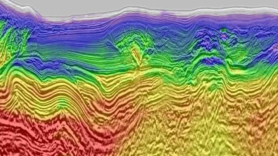
Full-Waveform Inversion
Get highly detailed, data-driven models of subsurface velocity, absorption and reflectivity from full-waveform inversion (FWI).
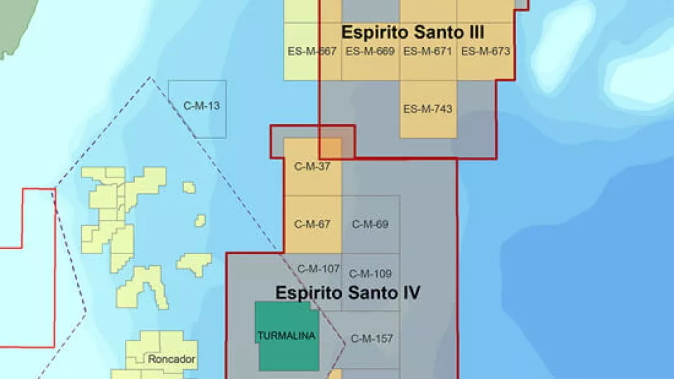
Espirito Santo
Access more than 22,000 square kilometers of high-quality 3D seismic data located at the southern end of the Espirito Santo Basin.

Foz do Amazonas
Gain a better understanding of geological potential with seismic datasets from the Foz do Amazonas Basin.
Explore available multi-client data using our interactive map.
Explore the GeoStore