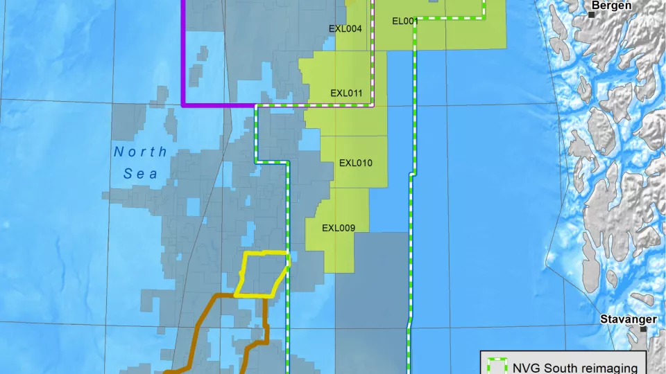
Southern Viking Graben
Explore this highly prolific area of the NCS using high-quality 3D
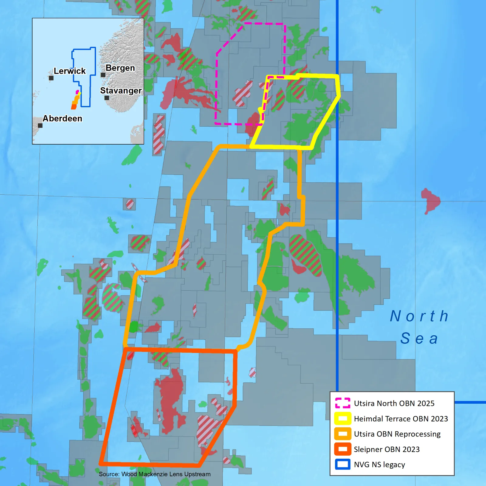
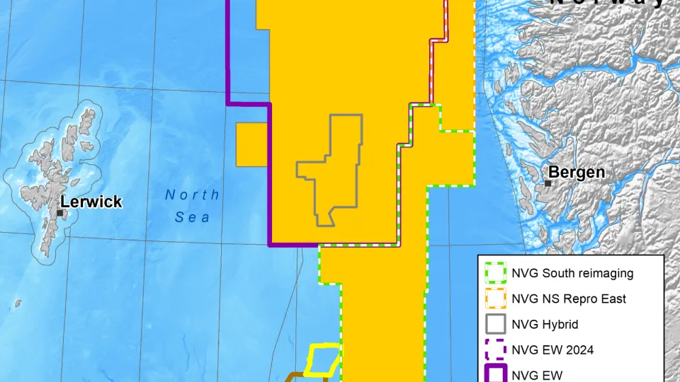
Viridien, in collaboration with TGS, has significantly expanded its seismic data library on the Norwegian Continental Shelf (NCS) through the completion of two Ocean Bottom Node (OBN) surveys in the Heimdal Terrace and Sleipner area of the Southern Viking Graben.
In addition, a recent reimaging of the Utsira OBN survey—conducted in association with TGS and Aquila Holdings ASA (via its subsidiary Axxis Multi-Client AS)—has contributed to a growing regional OBN footprint that now exceeds 4,000 km2.
The three OBN surveys have been seamlessly merged to form the OMEGA Merge—a unified dataset representing the largest contiguous 3D OBN volume on the NCS. This integration supports advanced subsurface imaging and future exploration initiatives.
Building on this momentum, Viridien has announced the commencement of the processing and imaging phase for the Utsira North OBN survey in the Norwegian North Sea, following the completion of acquisition this summer. Final data will be available for industry licensing in Q3 2026, further expanding high-resolution coverage across the region.
Cutting-edge seismic technology for complex geology
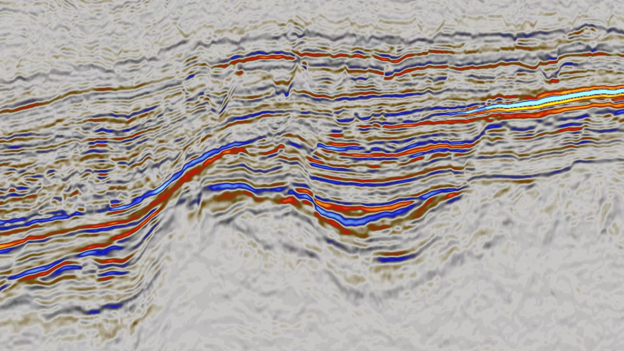
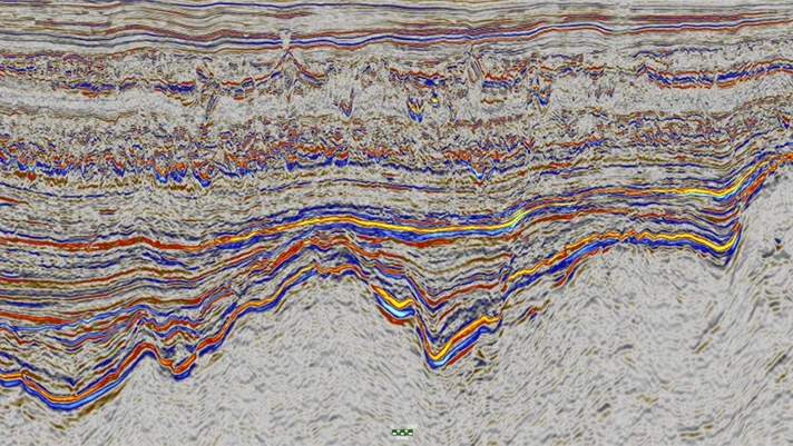
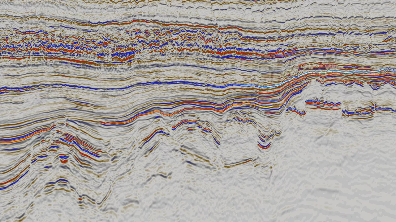
Our proprietary OBN processing and imaging technology, including time-lag full-waveform inversion (TL-FWI), delivers exceptional 3D seismic volumes that address the region’s geological complexity.
Key benefits of OBN acquisition in the Southern Viking Graben:
- Enhanced illumination and resolution of complex geological features, including sand distribution and fault structures
- Improved velocity models for accurate depth conversion, enabled by longer offsets
- High signal-to-noise ratio with excellent amplitude preservation
Superior data for confident exploration
The newly imaged data shows a significant improvement in resolution and structural clarity over legacy datasets. This enhanced imaging —complete with depth-time conversion— provides critical insights into the region’s subsurface and reservoir potential.
Explorers operating in the Southern Viking Graben can now access high-quality, integrated seismic data to support confident decision-making for years to come.
Related Surveys
Northern Viking Graben
Mitigate near-field risk in the Northern North Sea with a new dual-azimuth volume.
NCS Licensing Rounds
Best-in-class seismic and CCUS expertise to support developments on the Norwegian Continental Shelf.
Southern Northern Sea
Evaluate Southern North Sea prospects with 3D seismic.
Explore available multi-client data using our interactive map.
Explore the Geostore