Zambezi Delta Offshore Seismic Survey
Get high-quality seismic for Mozambique 6th Licensing Round
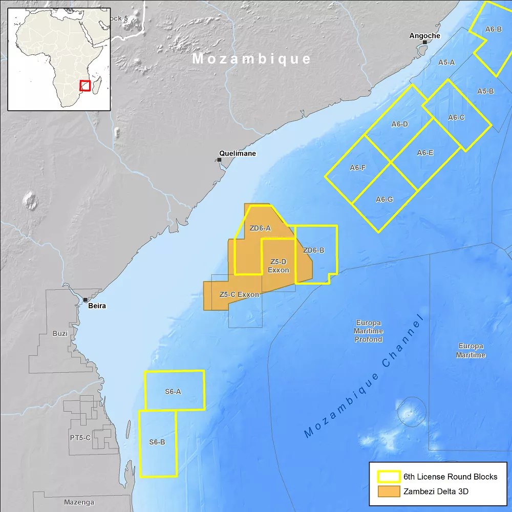
Instituto Nacional De Petróleo (INP), on behalf of the Government of Mozambique, announced the launch of its 6th licensing round in November 2021 to promote exploration and production activity in its offshore basins. Bidding is expected to close in October 2022, with results revealed in November 2022.
The licensing round consists of 16 areas along the Rovuma, Angoche, Zambezi and Save offshore basins, with a total acreage of over 91,000 km2.
In 2018, Viridien, in collaboration with the INP, acquired 15,400 km2 of offshore 3D broadband multi-client seismic and potential field data along the Zambezi Basin. The resulting data volume benefits from the latest proprietary Viridien imaging technology. Viridien’s data coverage, in conjunction with an integrated geoscience data and interpretation package, provides a detailed analysis of the petroleum system elements in the area and sheds light on its potential prospectivity.
3D Broadband data for exploration insight offshore Mozambique
- Offshore seismic survey with over 15,000 km2 of 3D broadband multi-client seismic data
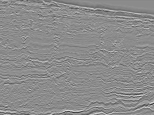
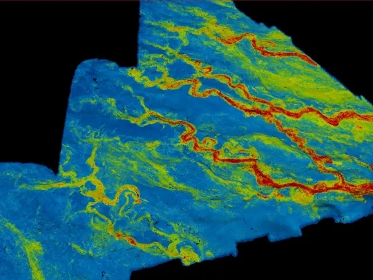
- High-quality PSDM data with FWI model — identifies key stratigraphic intervals and delivers high-resolution images of the Zambezi Delta turbidite fans and channels
- Reveals previously unseen detail of faulting and layering in the basement core of the Beira High


Key deliverables
- PSDM full offset stack, angle stacks, velocity models and gathers along with acquisition and processing reports
- High-resolution shallow hazard PSDM volume
- Gravity and magnetic data
- Complementary integrated geoscience package available, which builds on the advanced seismic dataset and incorporates well data, satellite seeps and geochemical data along with an extensive portfolio of geological studies
Mozambique Channel — emerging plays in a frontier basin
The structural configuration of the Zambezi Delta Basin provides evidence of a complex regional geodynamic evolution, with multi-phased plate tectonism and reconfiguration.
The Zambezi Delta Basin is one of the oldest offshore basins in the East African margin, formed due to the onset of Early Jurassic rifting and subsequent breakup of Eastern Gondwana. The tectonostratigraphic configuration of the basin, observed in Viridien’s 3D seismic and gravity and magnetic data, reveals an area with high prospective potential.
Several wells and producing fields in the shallow waters have proven the presence of a Cretaceous play along the Zambezi Basin.
The Tertiary sedimentary sequence, formed as a result of the onset of the Proto-Zambezi delta, could potentially open a new play concept in the basin comparable to the world-class turbiditic reservoirs along the Northern Mozambique (Rovuma Basin) margin. A review of source rock data and petroleum systems analysis has also shown potential for an oil play in Jurassic-aged sediments.

Related Technology & Surveys
Gabon
Explore Gabon’s prospective South Basin with 3D broadband multi-client seismic data and complementary long-offset 2D data.
Full-Waveform Inversion
Get highly detailed, data-driven models of subsurface velocity, absorption and reflectivity from full-waveform inversion (FWI).
East Africa Regional Survey
Link discoveries offshore East Africa with our long-offset 2D multi-client data that spans several basins.
Explore available multi-client data using our interactive map.
Explore the GeoStore


