Uruguay 3D Reimaging
Identify exploration risk and new production targets with high-quality images
Recent discoveries offshore Namibia have shed a renewed light on the Uruguay conjugate margin, where similar formation conditions have reproduced similar plays.
Viridien has finished the reprocessing of 25,000 km2 of legacy seismic 3D data offshore Uruguay using the most advanced imaging technologies, such as TL-FWI, to enhance existing data and provide previously unseen details of the deepwater formations of the South American nation.
This multiclient project has been completed, and full-track least squares-KPSDM images are now available. Contact your Viridien representative to book a data viewing session.
Reducing geological uncertainty with advanced imaging
Still considered a frontier basin, deepwater Uruguay has similar geological elements at basin scale to Namibia’s high-potential Orange Basin, plus unique aspects at prospect scale that could help to achieve exploration success at Cretaceous stratigraphic levels. For more, read our recent GeoExpro article: Exploring deeper in Uruguay: Could Namibia’s successful Cretaceous play be chased in Uruguay’s deepwater?

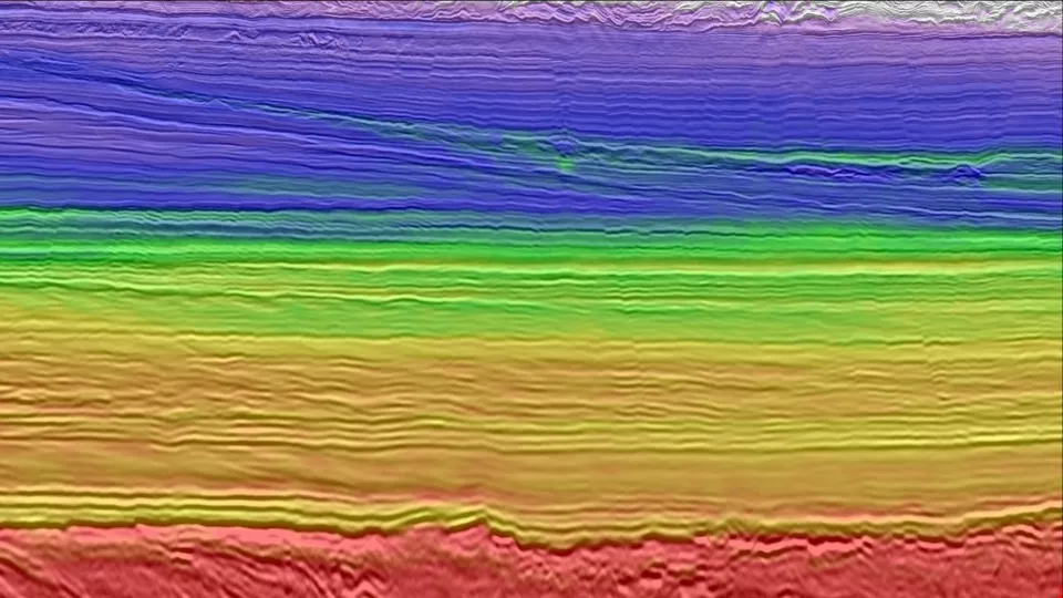
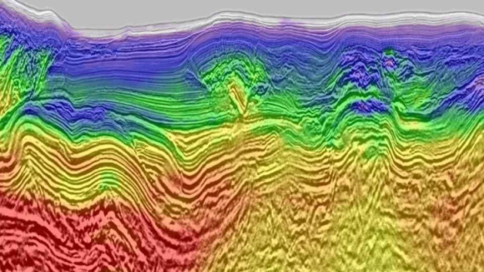
Legacy imaging (before) compared to reimaging using Viridien's advanced time-lag FWI imaging (after).
Video: Uruguay Offshore Reimaging
Reprocessed data helps improve geological understanding of the progressive subsidence of the Uruguayan offshore margin, structure interpolation and amplitude fidelity, thus helping reduce exploration risks and generate potential new targets in this exciting frontier basin.
Related Technology & Surveys
Full-Waveform Inversion
Get highly detailed, data-driven models of subsurface velocity, absorption and reflectivity from full-waveform inversion (FWI).
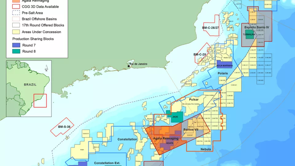
Santos and Campos Basins
Explore South America’s offshore pre-salt with high-quality, broadband, pre-stack depth migrated seismic data.

Foz do Amazonas
Gain a better understanding of geological potential with seismic datasets from the Foz do Amazonas Basin.
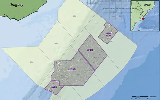
Explore available multi-client data using our interactive map
Explore the Geostore